How Drones Are Enhancing Real Estate Listings and Inspections
Imagine viewing a property listing online and getting a bird’s-eye view of the entire estate, complete with a seamless tour of the home’s interior and exterior. This is not a futuristic fantasy but a reality enabled by drones in real estate today.
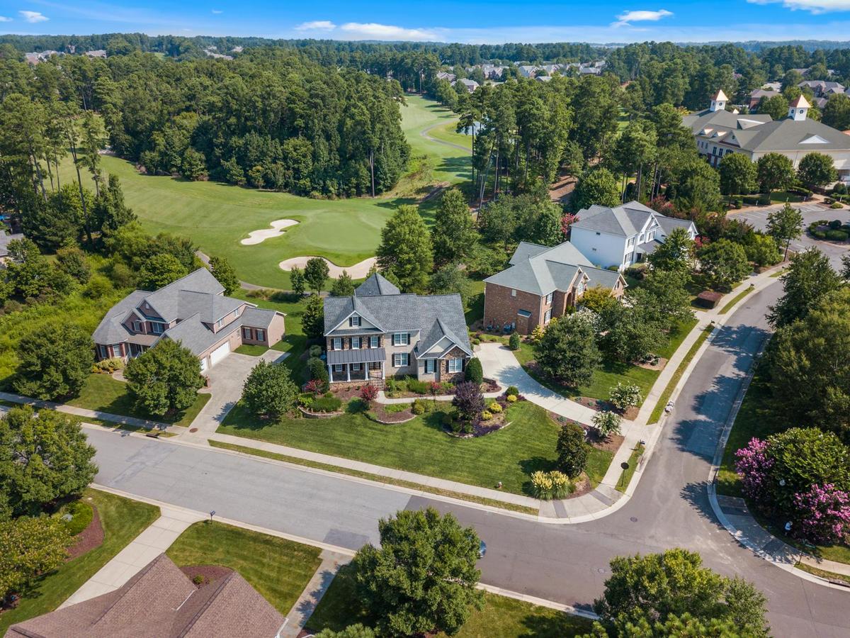
Drones have revolutionized the way real estate listings and inspections are conducted, offering potential buyers and real estate professionals a comprehensive perspective that was once hard to achieve. By providing aerial photography and videography, drones enhance the visual appeal of property listings, making them more attractive and informative.
The Rise of Drones in Real Estate
According to a report by the National Association of Realtors, 29% of real estate agents use drones for their listings. This technology’s popularity is growing due to its ability to showcase properties in ways traditional photography cannot. Aerial views give potential buyers a better sense of the property’s layout, surrounding environment, and unique features like swimming pools, gardens, or proximity to amenities.
Expert Insights
“Drones provide a unique perspective that enhances the storytelling aspect of a real estate listing, capturing not just the property but its context,” says Emily Larsen, a real estate technology analyst.
Benefits of Using Drones
- Enhanced Listings: Aerial shots can highlight the scale and layout of a property, giving buyers a clearer understanding of what they are investing in.
- Accurate Inspections: Drones can quickly and safely inspect rooftops and other hard-to-reach areas, reducing the need for ladders or scaffolding.
- Cost-Effective: Compared to hiring a helicopter for aerial shots, drones are far more affordable and accessible.
A Practical Guide to Using Drones
For real estate professionals considering drone technology, here are some practical tips:
- Understand Regulations: Ensure compliance with local laws and regulations related to drone usage.
- Invest in Quality: Choose a drone with high-resolution camera capabilities to ensure professional-quality images and videos.
- Training: Consider professional training or hiring a certified drone operator to ensure safety and quality.
Comparison Table: Traditional vs. Drone-Enabled Real Estate Listings
| Aspect | Traditional Listings | Drone-Enabled Listings |
|---|---|---|
| Photography | Ground-level only | Aerial and ground-level |
| Inspection | Manual, labor-intensive | Automated, efficient |
| Cost | Varies, can be high | Generally lower |
| Safety | Involves risks | Minimizes risks |
| Market Appeal | Standard | High appeal |
| Detail | Limited | Comprehensive |
| Access | Restricted | Broad access |
| Time | Time-consuming | Quick turnaround |
Conclusion
The integration of drones into real estate is a game-changer, offering a fresh perspective and enhanced value to listings and inspections. As technology continues to advance, the opportunities for more immersive and detailed property showcases will only increase. By adopting drones, real estate professionals can stay ahead of the curve, providing exceptional service and engaging potential buyers in new and exciting ways.
FAQs
How do drones improve real estate photography?
Drones provide unique aerial views, showcasing the property’s layout and surroundings, making listings more attractive and informative.
Are there regulations for using drones in real estate?
Yes, drone usage is subject to local laws and regulations, and compliance is essential.
What are the cost implications of using drones?
While there is an initial investment, drones are generally more cost-effective than traditional aerial photography methods like helicopters.


